Observation Targeting
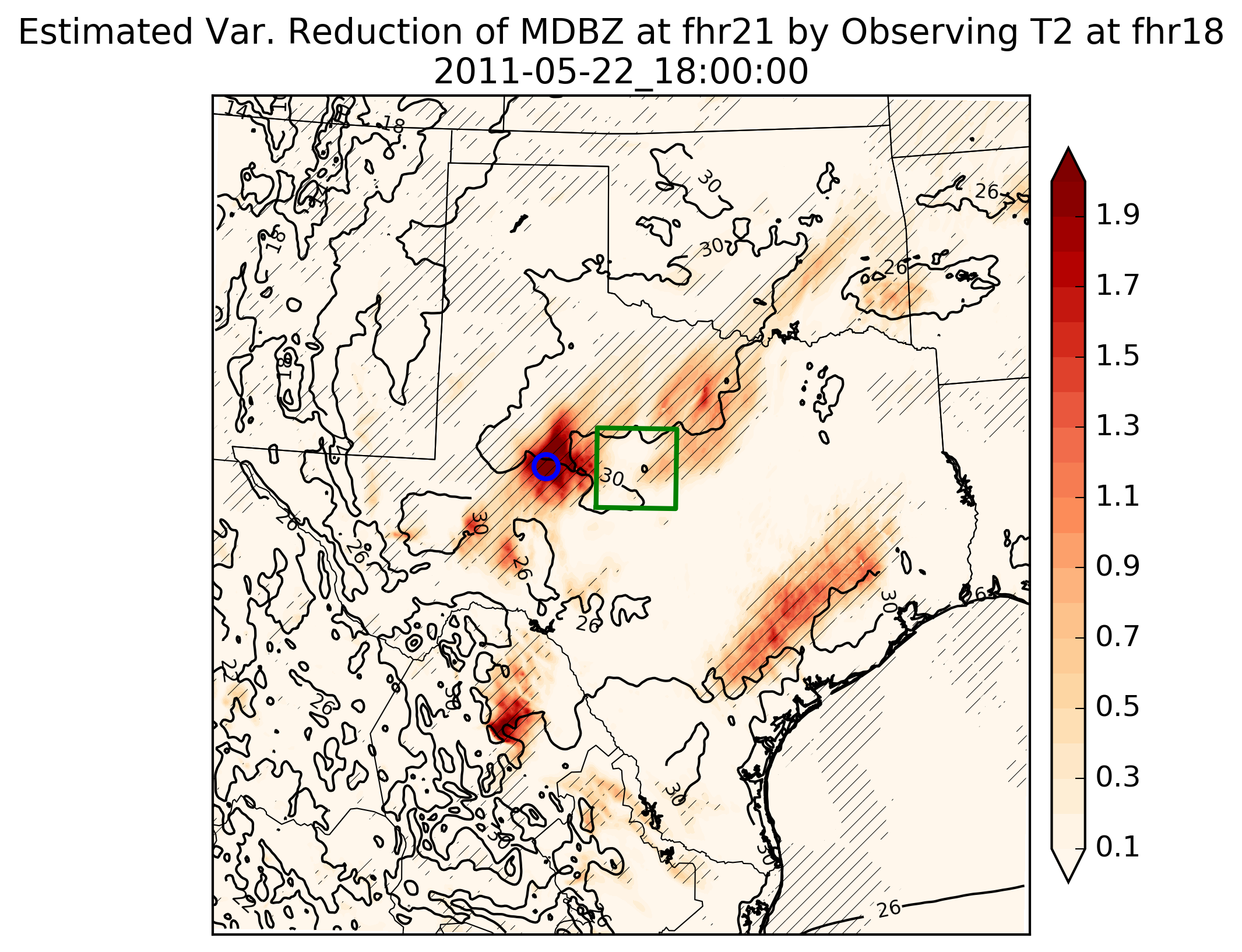
The typical notion is that more observations assimilated into numerical weather prediction models improves their analyses. A question remains, however, about where to optimally observe the atmospheric state in order to improve the forecasts. A variety of techniques exist to target observations, including the ensemble transform and singular vectors. A relatively newer technique exists that is computationally less expensive and is derived through the statistics of the non-linear model solutions. This method is derived from Ensemble Sensitivity Analysis (ESA). All that is needed beyond the forecast output is an estimate of observational error from the observing instrument. Mathematically, the procedure combines areas that are most uncertain in the model field along with the areas that are most sensitive, i.e. where errors have the potential to grow large. This post-processing field can be calculated across the domain to illustrate spatially where observations should be taken to improve a specific forecast (e.g. updraft helicity). An example of such a field is shown.
Our research group at Texas Tech is interested in applying this targeting technique to dryline convection and winter precipitation forecasts, as well as on short temportal and spatial scales with Unmanned Aerial Systems. Contact aaron.hill@ttu.edu for further information.
Our research group at Texas Tech is interested in applying this targeting technique to dryline convection and winter precipitation forecasts, as well as on short temportal and spatial scales with Unmanned Aerial Systems. Contact aaron.hill@ttu.edu for further information.