Chapter 24 Images
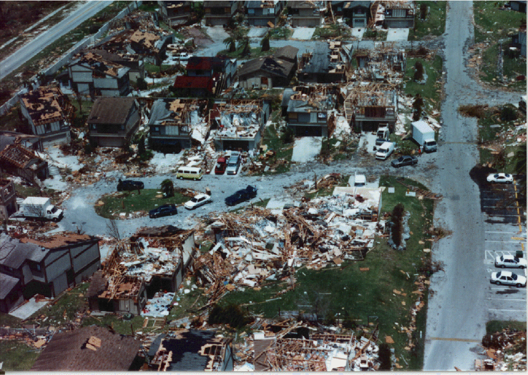
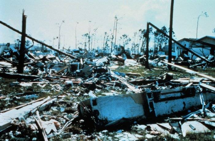
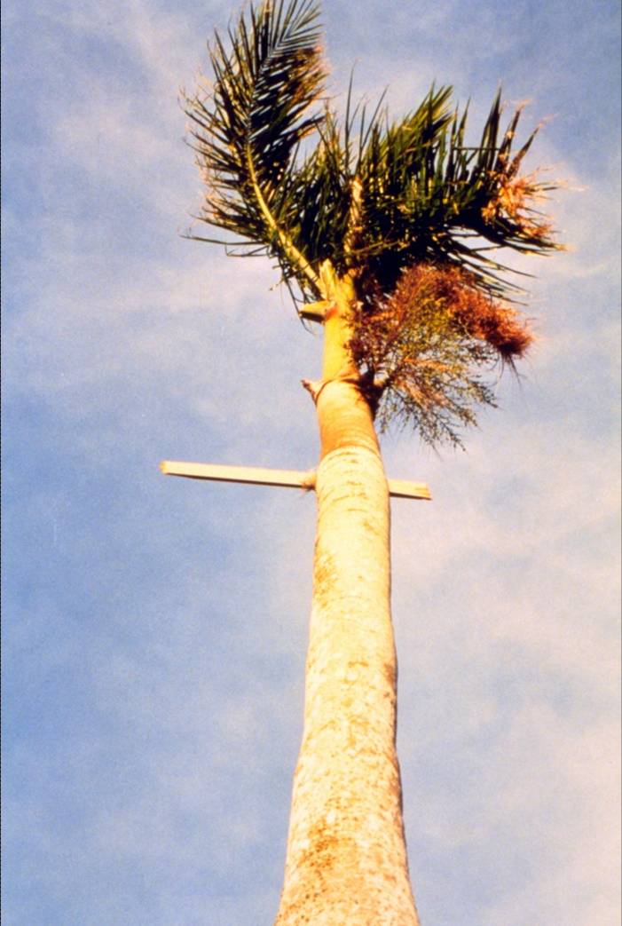
Hurricane damage pics: #1, #2, #3, #4, #5
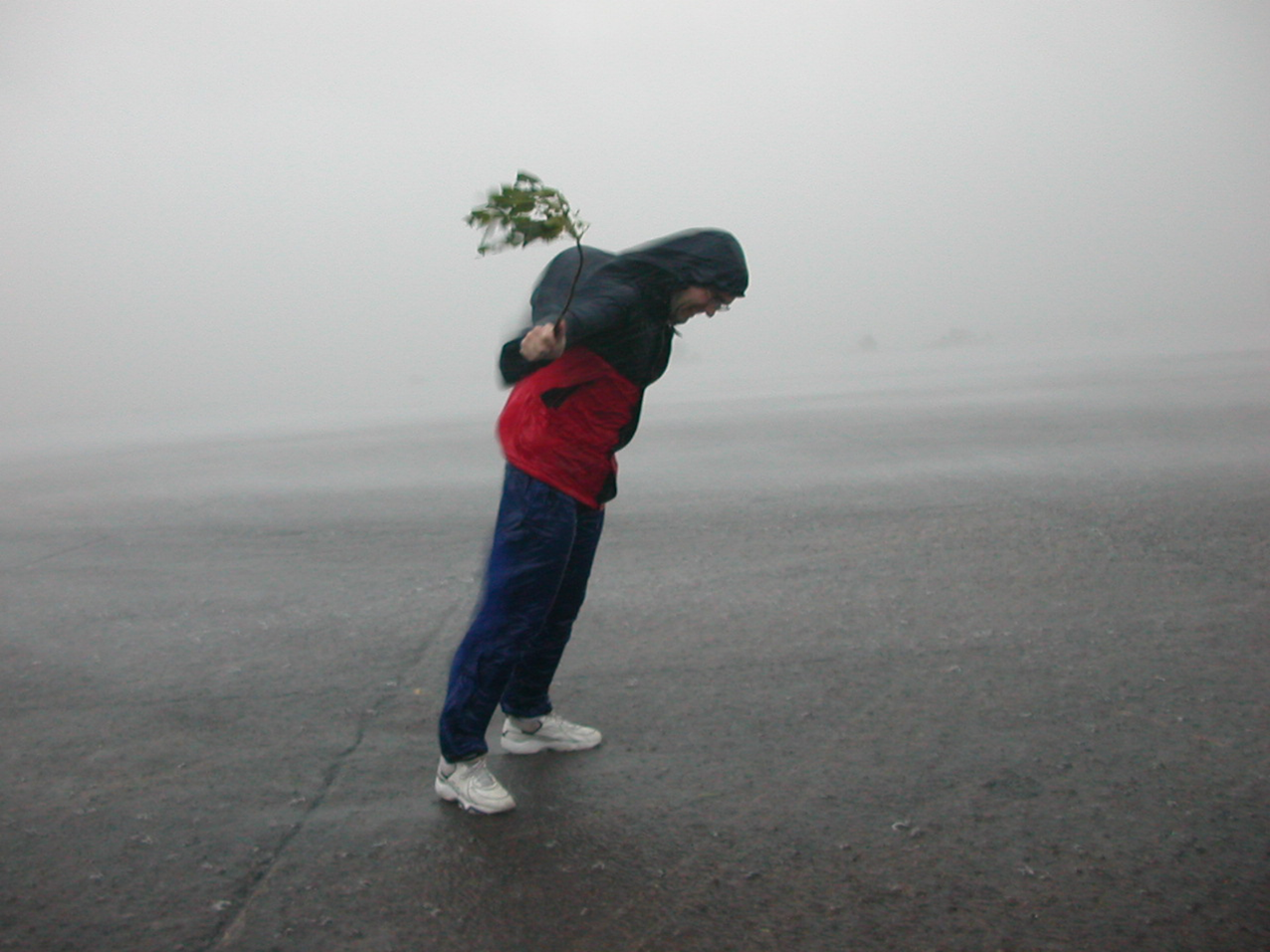
What happens when you stand in strong tropical storm-force winds.
The frequency of hurricane occurence by time of year. Note the peak is September 10th, but they can form well before and after that.
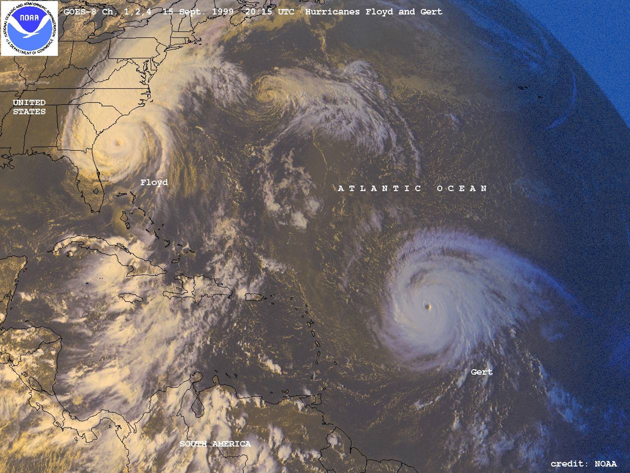
A satellite image of a tropical wave in the Carribean, a tropical depression approaching the Lesser Antilles, Tropical Storm Kyle weakening off the coast of Africa (note the intrusion of dry air into the center of the circulation - do you think this helps or hurts the hurricane?), and Hurricanes Floyd and Gary in 1999 (note symmetric satellite presentation of category 4 Gert).
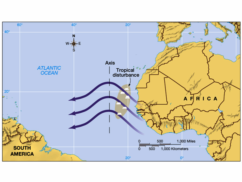
A schematic of a tropical wave off the coast of Africa. This is the birth region for a good number of tropical systems.
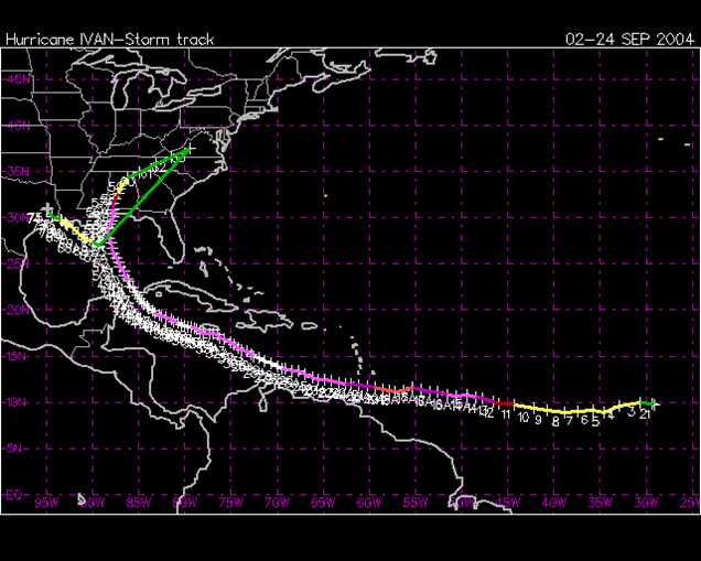
The full path of Hurricane Ivan across the Atlantic.
The erratic path of Hurricane Gordon, an example of a hurricane with a weak steering flow.
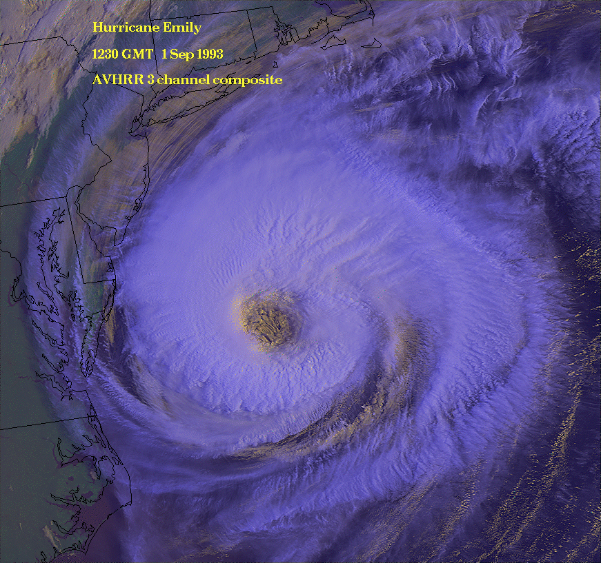
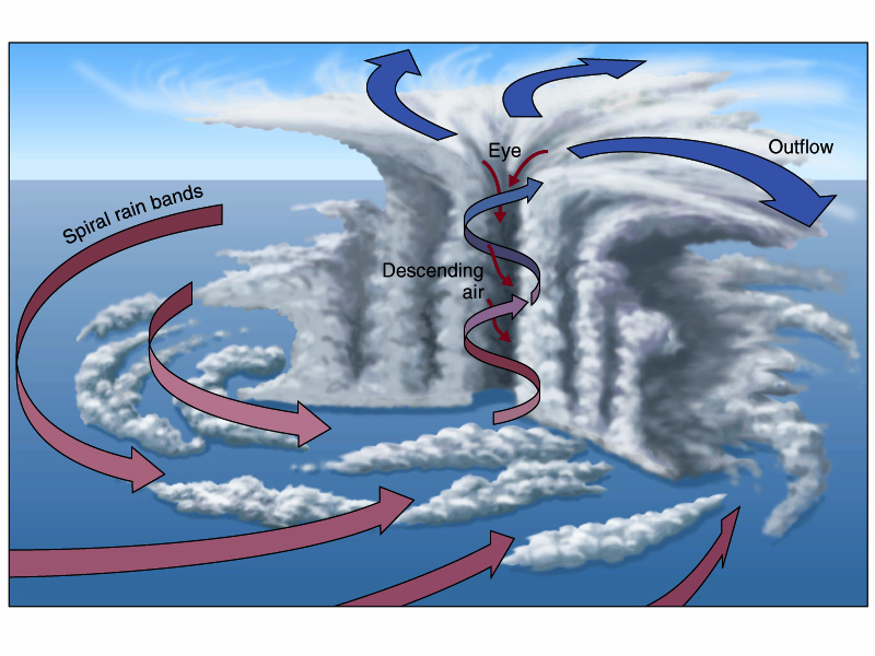
Examples of hurricane structure (Hurricanes Emily and Hugo). Note the large cloud-free region in the center referred to as the "eye", the area of intense convection surrounding the eye (the "eyewall"), and the bands of convection rotating around the center (the "spiral rainbands").
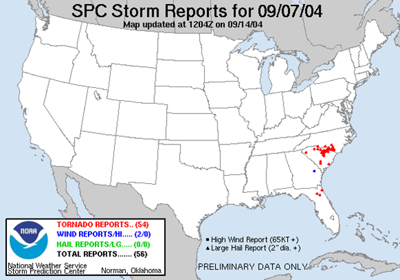
Storm Prediction Center tornado log for 7 September 2004 during the landfall of Frances. The red dots plot tornado occurrence, the brown track is the path of the circulation center. Notice all tornado reports are to the right of the track. Why?
Cut out schematic of a typical hurricane. Compare this image to the examples of real hurricanes presented above.
A schematic of the effect of hurricane translation on wind speed. Which direction would you want to move relative to the eye to get the weakest winds?
The effects of storm surge.