Chapter 2 Images
Supplemental images used in lecture
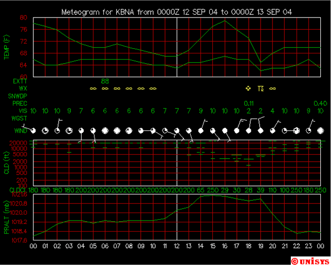
Surface weather map from standard ASOS observations
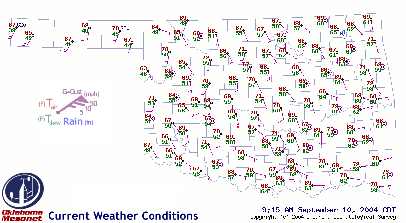
Surface map from the Oklahoma Mesonet - a much denser network!
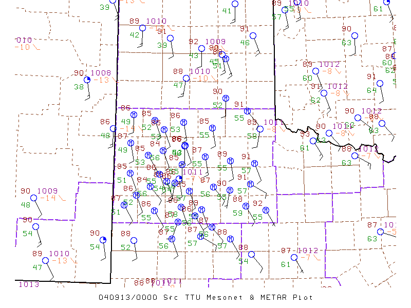
Surface map from the West Texas Mesonet - ditto!
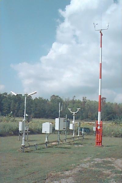
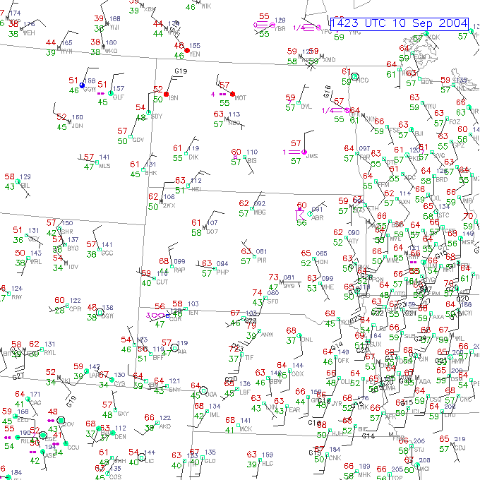
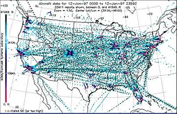
Locations of aircraft observations
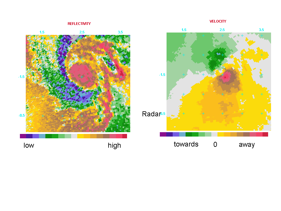
Mobile Doppler radar images of the 1998 Spencer, SD tornado. On the left hand side is reflectivity, on the right hand side is wind velocity to/from the radar. What is the sense of rotation? (clockwise/counter-clockwise)
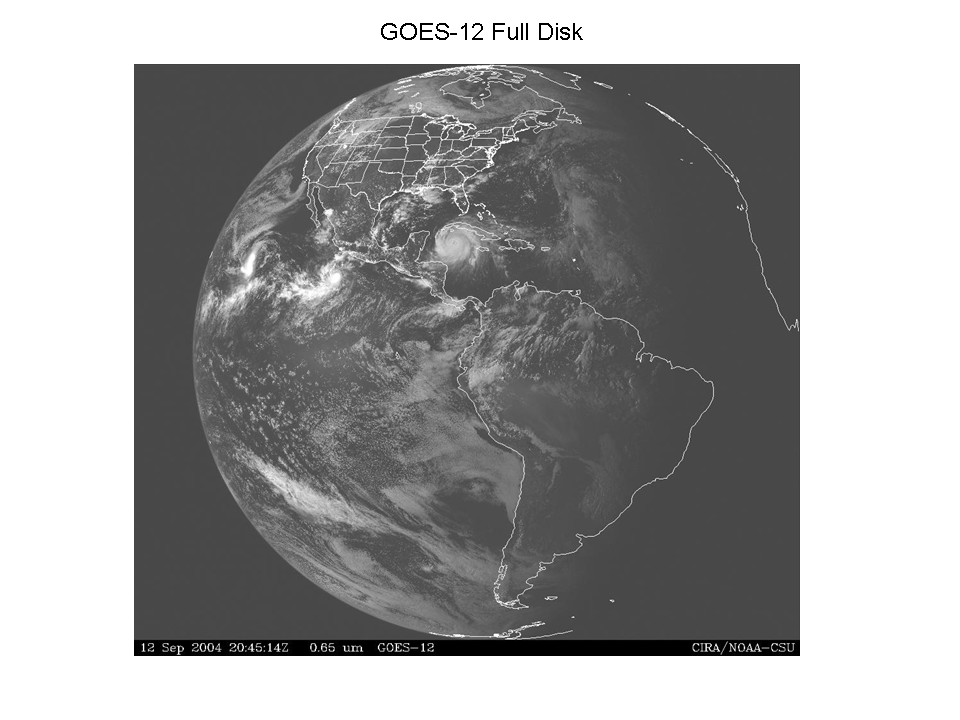
GOES-12 full disk image Hurricane Ivan shows up front and center. What type of satellite image is this? How can you tell?
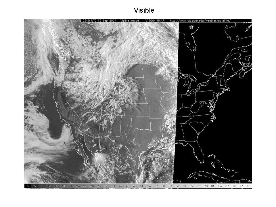
A comparison of a visible satellite image and infrared satellite image taken at the same time. What does each image tell you? How can you discern where tall clouds (e.g., thunderstorms) are versus low, shallow clouds (e.g., fog)?